Friday, April 29, 2011

Gear Review of Vasque Mindbender GTX

Vasque Mindbender GORE-TEX® Footwear


I only get to bring three pairs of shoes that need to work for me for 5 months. Motorcycle boots are a no-brainer. Obviously a pair of flip flops makes it into the mix because they are lightweight and very practical (showers, swimming, easy to put on in the middle of the night to go pee, …).
That leaves one more pair to do everything else. These better be some mutli-purpose shoes and they better be comfortable.
After some deliberation, I decided to go with the Vasque Mindbender GTX shoes for no other reason than they fit my feet so well. That's always a good start when choosing a shoe- fit. The roomy toebox allows my duck shaped feet some wiggle room and the stretch GORE-TEX® Panel across the tongue holds my instep securely in the shoe.
With fit taken care of, I need a shoe that is waterproof because walking and running through wet grass and shallow streams works a lot better with a shoe that doesn't let water in. Of course there is a giant hole in the top of the shoe (where my leg comes out) but keeping water out of the rest of the shoe is a good thing. 
Waterproofness and durability are also top on the list since I don't like wet feet and I can't exactly get a new pair of shoes half way through the trip. With a GORE-TEX® Liner, my feet stay dry (unless I fall in a creek and the water comes over the top) and since Gore is always involved in the design and testing of the shoe, it is going to be durably waterproof.
It is hard to get exercise on a long motorcycle trip and running is one of the few ways I've managed to get my heart rate up. The Mindbenders are designed to be trail running shoes (and they are great at doing that) but I've pushed them quite a bit and run on the pavement as well. I've probably logged 150km of street running this trip and so my knees seem to be doing ok.
If there is a downside to these shoes (and every review needs to talk about some place for improvement), the rubber outsole on my right heel came detached from the midsole somewhat early on. It is now a little flapper on the back of the shoe. I could easily reglue this, but just haven't gotten around to it. Also, and this will happen with any waterproof footwear, after I fell into creek and my shoe filled up with water, it took a long time to dry, and in the process got a little stinky.
But with 120 days on these shoes, I'd say they are doing pretty darn well. I'm planning on putting them on my feet today to go trekking in the mountains above Bariloche.

Thursday, April 28, 2011

Leaving Patagonia


We left Tortel in the usual rain and decided to head for a farm that may soon be underwater from the dam project (see previous post). Backtracking on the Austral for 60 km, we came to the turnoff for the Nadis River and headed for the confluence with the Baker. At the end of this track are a few very off the grid farms run by Patagons who worked this land for a couple of generations.


A German/ Chilean couple built a little cabin on their land and allow tourists to stay there for very cheap and enjoy the remoteness of the area. Large glaciated peaks tower over the biggest river in Chile with waterfalls dripping down the glacial cut forested walls of the valley. Just over the crest is the Northern Icefield with its tentacles of glaciers tumbling down valleys to feed the baker. It is a perfect spot to have a farm and to be removed from everything in the world. No electricity, no towns, no roads, no nothing.

We went for a walk around the land through the wet grass and watched birds and glaciers from the confluence of the rivers. This little guy didn't seem to mind us at all as he was staring into the river looking for what must be some yummy fish. After taking some 3000 photos, we decided to leave him alone. Thanks little buddy.


We went shopping for our dinner in the garden by digging up potatoes, and carrots and picking beans and peas out of the autumn garden. We picked up fresh german style bread from the owner. On our way back to the cabin, we saw the dad of the ranch carrying kittens over to the kids because he had just found them in the hay loft.

We fired up the wood stove, cooked a nice meal and enjoyed a relaxing night in a very remote area.


The next morning we woke up with pouring cold rain. With the snow level just 1000 feet above us, we contemplated staying another night, but new that we were running out of time. The Southern part of the Austral had grabbed us and slowed us way down, but after the looking at the calendar and counting backwards from when we have to leave Santiago, we very slowly and reluctantly packed up the bikes and headed off into the rain.
We have very good rain gear. And I will write a review about that later, but even though we stayed bone dry, our feet became little popsicles after 2 hours of miserable rain. We brewed up some tea in Cochrane to warm up but neither of us wanted to push on any further that day. So with only 60km of riding for the day we found a place to stay and warm up next to a stove.

It is a good thing we stopped because the next morning was bluebird beautiful and all the new precipitation had coated the mountains in perfect white. We headed north along the baker river to Lago General Carrera and then along the southern coast of this 100 mile long crystal blue lake. We stopped for a picnic on the beach and ate the rest of our german bread. It was a perfect way to leave Chilean Patagonia.

We crossed into Argentina without incident and for the next 3 days headed north battling Patagonian winds through the desert side of the mountains.
And now we are in Bariloche where we plan to spend three days in this idealistic resort town.


Along the Rio Baker.
This will all be underwater if the dam project goes through.
Drying out our stuff around the heater.

The perfect picnic spot


Bluebird, at last.

Patagonia Sin Represas o con Represasas?


That is the question. If you are like me and didn't know what a represa is but had seen billboards everywhere supporting one stance or the other then let me help you out.
A represa is a dam. And the question is whether to build 2-5 very large dam projects in the region of Patagonia where we just were. Oh course my first reaction is "no freakin' way!" but hold on there cowboy and lets look at the different sides and lets even see if I am allowed to have an opinion as such. For a very one-sided look, but well produced, take a look at this website to see about the projects.
If you have been reading my blog, you maybe can get a sense for how fantastic this part of the world is. We drove and drove and got a peep of a remote and wild landscape that just goes on and on and on and on. Ironic that we saw it from a road which when it was put in dramatically altered the landscape but granted access to it. However, if you look at a map you can see that there is a whole lot more that is not accessible by road which feels really good.
Why does it feel good? I think it incredibly important for our psyche as humans to know there are places in the planet that are incredibly hard to get to and that are relatively unaltered by humans. Places where things can happen "naturally" and where an animal or plant may never know that humans exist. We need these places and there are very few of them in the world. The thing about these types of places is that once we affect them, it is very hard to go back. Or… if we do have an impact then we should try to minimize our impact in small ways.
Patagonian Chile has some mighty big rivers fed by some mighty big icefields and glaciers.
The Rio Baker is a turquoise blue or dull green (depending on how far down river you are looking at it) with a flow of 1000 cubic meters per second. That is a cube of water 30 feet by 30 feet by 30 feet passing by every second. It cuts through a few rock canyons on it 700 foot drop from the second largest lake in South America to the Pacific Ocean at Tortel. Depending on how you look at it, it just begs to have some dams put on it or it is spectacular river unlike anything I have ever seen and needs to be preserved as such. Megan and I both marveled at this river as we drove along it commenting that we just don't have rivers like this in the states- they are all dammed.
[perfect for damming] The plan is to build 2 mega dams along this bad boy and send the energy via high tension power lines thousands of miles up north to Santiago and even further north to the copper mines. There is also a plan to build another 3 dams further south of O'Higgins on the river that drains Lake O'Higgins.
Why does Chile need this much energy? Depends who you talk to, but copper mining is the source of income for Chile and copper mining needs energy. Also, Santiago is a growing metropolis and needs more electricity. The way it is put, they can get it from Hydro, or they can get it from burning gas.
Who wants to see a dam go in? The impact would be huge. Thousands of large construction trucks driving up and down the Austral. New roads put in to create the power lines? Enormous lakes where once there was only a beautiful river. 
My thought is this, and it is easy for me to have this thought since I don't actually have to make a decision and since I certainly do not know all of the facts, but thats what we do, make judgements on things without knowing all of the facts and without actually having to be culpable for our decisions, right?
Does Chile actually "need" the energy? Are there energy savings that can be made to put off needing more electricity? I bet there is. If in fact, they do need more energy, can they get it from smaller scale projects like microdams, solar (there is plenty of that in the north), and wind? I know these things cost more money are more of a pain in the butt than 2-3 mega dams, but is it worth the sacrifice to save these parts of Patagonia?
I suspect a few people and corporations have a lot to gain by building these new dams. These people have a lot of power and sway and know that if they keep pushing, the general apathy of society will allow it to happen.
But I'm just a guy who drove through on a motorcycle, burning gas the whole way, using electricity when it was available and who doesn't actually have to live with the affects of the project (or lack thereof). I think it is important for me to get information and form an opinion, but I have to keep an open mind and allow for the fact that I don't know everything and that my opinion could need to change. Or that if I hold my opinion, than my lifestyle could need to change to support my thoughts.

How did we get thrust into the Represas debate so quickly? Well, we drove through Patagonia for a while and were deeply affected by what we saw. But after finally getting gas in O'Higgins we decided to stay a night in Tortel, a town that until about 8 years ago was only accessible by boat. This town is built on the edge of a fjord with no flat land available anywhere. People just built their houses into the hillsides and then connected them by wooden walkways. So Tortel has no streets, only raised wooden walkways that zigzag down 7 km of rugged coastline. It is a interesting place to visit. 
It is also a difficult place to find safe parking for the motorcycles since there is generally a large (unsecure) gravel lot where cars park and then you walk into town.
We managed to find a dumpy place to stay that allowed our bikes to be somewhat close to us and since our bikes comfort is more important than ours, we hunkered down here for the night. As we were getting ready to cook our Pasta Panamericana for the night a french guy comes walking into town and also stays in our small little place. Since there is literally no open restaurant in town (it is low season), we offered to cook him food and we chatted. Turns out he is a journalist with a french new agency doing a 1 hour documentary on the dams. His angle is to interview the scientists who are measuring the impact of the project and doing the research on what the ecosystems of Patagonia. He's a very thoughtful, energetic person who has learned a lot about the projects, their impacts, and the implications. For those of you in Seattle, he reminded me a lot of Frank Huster (not only because he is french) but by his throw himself at the world with enthusiasm approach.As any good journalist (not editorialist) he refuses to have an opinion until after he has finished he work. He can see all sides of the story and I think because of this has been granted access to all sorts of interesting people. 
We thoroughly enjoyed passing a rainy evening huddled around a small wood stove learning about what Antoin had learned about.
I look forward to his documentary even though it will be in French. Perhaps I can get someone to translate for me.

Wednesday, April 20, 2011

Dependence on Fossil Fuels

[Our Hostel in O'higgins] We have felt more than a little guilt over the fact that we are burning gas pretty much for the sake of burning gas this entire trip. My back of the envelope calculation says that between our two bikes we have burned 525 gallons of gas to get from Seattle to here. (around 17000 miles at 65 miles per gallon times 2 bikes). I justify this in my head in that to fly down here would take more gasoline than this and people fly down here all the time. But then when we flew back to Chicago for just a week a felt very guilty for that gas consumption.
Two main thoughts come to mind about gas.
1) It seems like nothing less than a miracle that we can drive all the way from Seattle to the Southern tip of the Austral and be able to find this extremely hard to find and manufacture substance called gasoline. That even the most remote places of the earth, we can find places every 200 miles or so that allow our machines to keep running for another 200 miles. That the price for this stuff is so inexpensive (ranging from $1/ gallon in Bolivia to $9/ gallon in Chile- ironically there are far more cars in Chile than Bolivia) that we can actually drive all over the place just for fun. I know full well that those times are quickly coming to an end and that in 20 years time a trip like this will be so expensive that almost no one could afford to do it. Look how lucky we are!
2) The was cooler way to do a trip like this would be to do it on bicycles. This would remove most of the guilt of fossil fuel dependance (except for the pesky plane ride home) and would be like our experience times 1000.

This dependence on fossil fuels for our trip was made down right apparent in Villa O'Higgins. O'Higgins is 170 miles south of the last gas station. Although we carry an extra gallon of fuel (60 miles range for 1 bike), the 340 mile round trip is must too far for our bikes. However, we heard that it was possible to buy gas in O'Higgins, so that even if the gas cost $15/gallon we could make it work.
Our plan was to go to O'Higgins, spend the night and then work our way back north the next day and onward to Argentina and the Bariloche area. With about 2 weeks left in our trip we have time to go slow, but we have to keep moving a little bit. We celebrated with our Tequila and coffee, then turned around and went to little place that sells gas. The guy turned on the pump, put the nozzle into my tank, squeezed the trigger and nothing came out. He went inside and got a can of WD40, sprayed it in random places on the pump, tried again and still nothing came out. 
He looked at us, shrugged his shoulders and said "Sorry, no gas today." We asked him when there might be gas and he said he didn't know. It depends on when he could fix the pump. We asked about other options and he said we could go to Cochrane which is the town 170 miles north of here. When we pressed him further on the time to fix the pump he said that maybe he could get it working later in the day but that he would probably have to call someone to come down and that could be several days.

[O'higgins] So here we are in O'higgins. Stranded without gas until we don't know when. But this is Patagonia and we are very far from anywhere. The fact that we can get gas at all is amazing so waiting a few days for it is no problem.
In fact we welcome the break. The temptation is to ride everyday and see a lot of things. But as we have been asked a few times-in my paraphrased spanish- No pueden conocer nada si siempre estan manejando. (You can't get to know anything if you are always driving)- ***Side note: I really like the word Conocer in spanish. Spanish has two words for "to know"- Conocer and Saber. Saber is to know something- like in theory or knowledgable. Conocer is to actually know something- like to get to know or know it first hand. There is a big difference and one that english doesn't always make.***

Yesterday we went for a hike up a valley towards a very large glacier. We hiked on a muddy path for 6-7 miles up valley, and then turned around and came back. We saw lots of second growth forest (I still don't understand how they extract the trees without roads) but also saw some amazing Patagonian Old Growth Cypress forest. 


At the end of the line for us was a cute little hut where people could stay if the wanted. I ate a yummy can of Salmon and burped fish all the way back.
The trail was extra muddy because a few cows had decided to always go for a hike and they destroyed the trail but we made it to be a bog game of hot lava monster and it was kind of fun.


Today we are going to bake bread and write on the blog, and perhaps tomorrow we will leave, if our dependance on fossil fuels will let us.


Moto note:
We found a mechanic in Coyhaique to "fix" megan's leaky fork seal. They didn't have the part, but they did take apart her fork, clean up the seal, put a firmer spring around it, and replace all the fork oil. It seams to be holding. However, later that day, my fork seal started to leak. And then it really started to leak. The problem is that once there is oil on the fork, dirt sticks to the oil which then gets pushed into the seal and makes it worse.


I fashioned this homemade boot around the telescopic part to keep dirt off by using an old rag, a ziptie and our sewing kit. It seems to be keeping dirt off of the fork which is good, but I am still loosing quite a bit of oil. I hope I can make it to Bariloche on this thing where I hear there is a good mechanic.


A town of one

There are big towns and there are small towns. Each town has its own feel and this comes from a combination of the place where the town is, the community/ history of the town, and the visitors own personal attitude/ experience in that town.
The pure physical location of a town can very much dictate its characteristics. A town on the ocean with plenty of food will be very different from the same town out in the middle of the desert or high up in the mountains. A town that is surrounded by fertile land will have a different sense of time than a town that exists solely for tourism. What that feel of the town is will be based on the history/ community.
The personality of the town comes from the collective experience of the people in there. How long has it been there? What type of organization is there in the town? How do people interact and do they welcome visitors or do they see visitors as space aliens who can only negatively affect them?
Then there are the visitors. Your attitude upon arrival can have everything to do with how you come to be in that place. What do you expect to find? Are you just taking from the place, or do you have something to share? Do you plan on leaving the place with the attitude that you would like to go back and be welcomed or has it been a long day, you can't communicate with people, and you just get off on the wrong foot?
Of course, I use the word "town" as if it were an entity it itself. It isn't. Each person is their own person, but as a traveler you tend to make generalizations about places base on what you experience. This isn't fair, but it happens. Just read any guidebook and you will see these types of generalizations made about anyplace. Its what we do as humans (west coasters vs east coasters, democrats vs. republicans, men vs. women).

On the southern part of Carretera Austral, there is a section towards the end where they haven't built a road. The government runs a free ferry that travels the 20km or so through a fjord. There is a time schedule for this ferry, but we were so far removed from the concept of time (and getting that information seemed difficult) that we just knew we would show up and take the ferry when we could. Because of the stranded dog episode, our day was getting a bit late but we hoped for a 4 o'clock ferry which would deliver us to the other side by 4:45 which would allow us 2 hours to drive the final 100km of the Austral into Villa O'Higgins before dark. Upon arrival, we found out that the ferry didn't go until 5.
Leaving at 5 would mean either a) driving in the dark in the pouring rain (did I mention it was 40 degrees and raining) or b) finding a place to camp somewhere along the way. We made a at the beginning of this trip to not plan on driving in the dark (we have only had to do it 3 times) and camping in the freezing rain sounded kind of not fun.
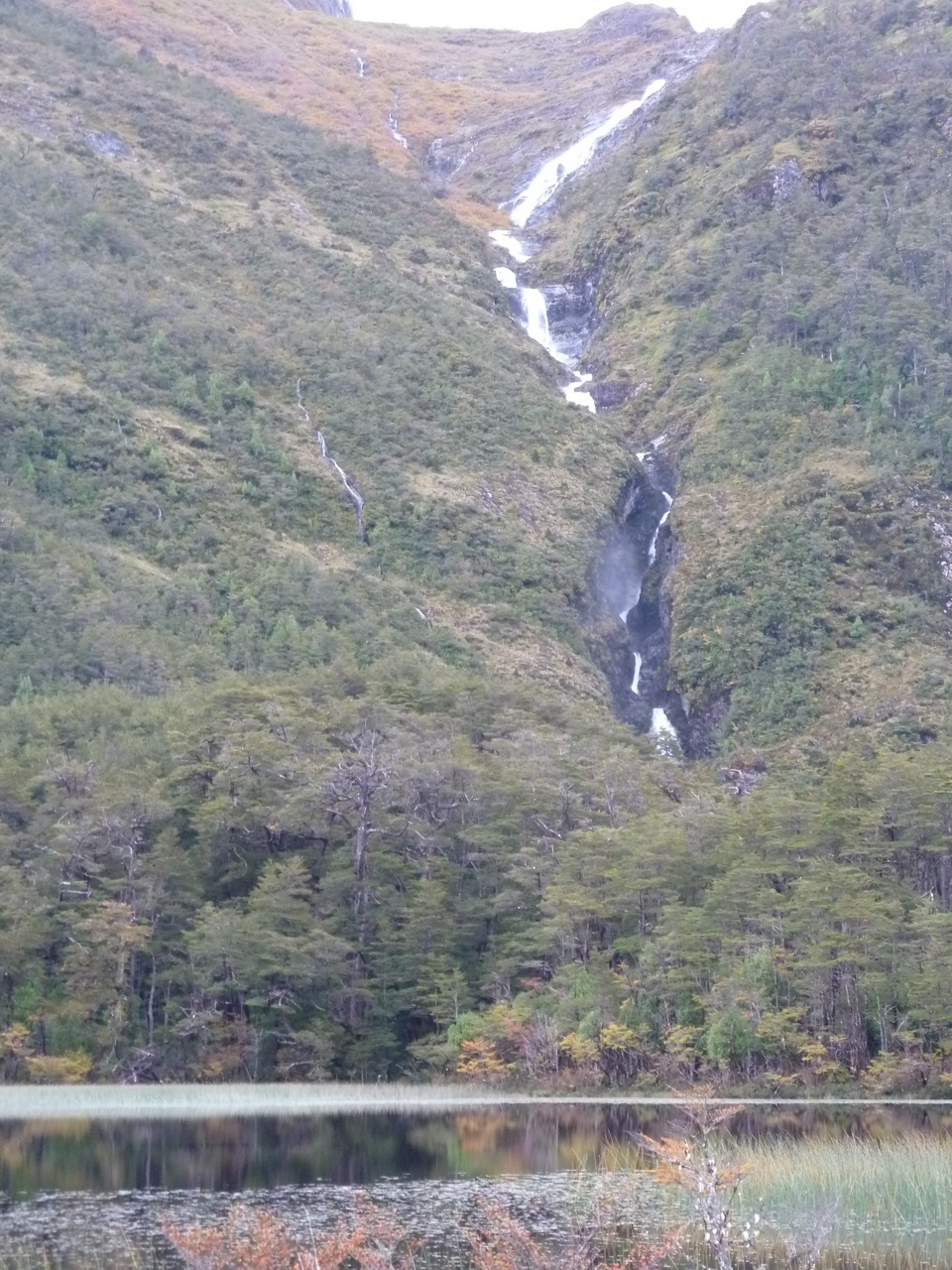
The town where the ferry leaves from is called Puerto Yangay. It is an ex-military outpost in the bottom of a glacial valley with snow capped peaks guarding over it. There are 5 government houses and a cement ramp that goes into the water where the ferry picks you up. There is a small kiosko (café/ warming hut/ store) that relies on business from people waiting for the ferry. In the Summer months, she can get 500 travelers/ day but in the Fall she gets 2 (that's us). 
We went inside to get some Nescafé, homemade empenadas, and to warm up by the fire. We talked about what to do. Should we just go for it and see what happens on the other side of the ferry? Or should we attempt to hunker down here for the night and play it safe. With her typical smile, Megan asked the women who runs the kiosko about places to stay and the woman said there were none. She also said a bunch of other stuff, but we didn't really understand through her thick chilean accent. The closest town, Tortel, was about 30 km back on the road and we didn't want to go back there. This town also has a reputation (and I get back to the "feel of a town" here) for being not so nice to travelers. We had heard it from a motorcycle guy we ran into and we had heard it from some police we met ("they mix their gas with water- it is a nice place to visit but don't stay there")
We decided not to go for it and we decided we'd talk to the woman again about our options in Puerto Yangay. Maybe we could find a shelter to set up our tent under. That'd be better than camping out in the rain.
It turns out that the woman had told us before that we could stay in her house (one of the run down government houses). Her daughter and husband were not in town (they were 120km north in the bigger town so that her daughter could go to school). We asked how much and she looked at us like we were crazy. Why would she charge us?
So we waited around until 7 (when the last ferry crosses) passing the time and slowing down a bit. I went for a walk around town (this took 5 minutes) and tried to hike up to the weather tower but got bogged down in moss and swamp. We shared some Maté (the local tea) with Ines (the woman) and played with the ferry dog.
At 7 we went up to her humble house. She has no electricity but she does have a great wood stove and we watched as she baked bread for the next day. We chatted about this and that and about how she is the only inhabitant of Puerto Yangay. Sometimes some police stay at the military camp and the boat people live on the ferry but they rotate out every 20 days so she really is Puerto Yangay.
When the fresh bread came out of the wood fired oven, we put strawberry preserves on it (which she grows in the summer) and that was dinner. Yummy!
The point being that the town of Puerto Yangay is unique. It is in a very remote location, relies on tourism for it livelihood, and the entire feel of the town is currently dictated by one person. We approached it with open minds and time to spare and the town gave back to us. That's one aspect of traveling that is so great, the times when things don't go as planned but work out for the better.


The end of Austral and setting goals


Want to know what is at the end of the famous Carretera Austral (translated: Southern Road)? Let me tell you: A small hydroelectric plant.


So we made it to our second goal. The furthest south point on the Austral.


Before we did the calculations and figured out where we were, our previous goal had been to make it to the same latitude as our home in Seattle (47.66). Oddly, when we arrived at said latitude there was a little house which we decided we would buy and call our second home.


Isn't it cute? If anybody wants to visit, just let us know and we'll get you the keys. It is kind of a pain to get to but it in a really nice place. 
We have been loosely paying attention to our latitude since Santiago. Santiago is at the same latitude as the California/ Mexico border and feels like it.
Without studying a map, we wondered what the latitude of Seattle would feel like down here. It seems that the climate zones tend to compress a bit in southern Chile. By the time the time we were at the same latitude as San Francisco, it felt like we were in Oregon. By the time we were in Oregon (the start of the Austral), it felt like British Columbia and as we continued south it started to feel more like central BC. The tree line started coming down from what looked like 5000 feet at the start of the Austral to 1500 feet at the end (It is at 6000 feet in Seattle).

So to make sense of it all, I'd say that by the time we hit the latitude of Seattle we were more in the climate zone of the latitudes of the middle of BC (some 1000 miles north of Seattle). I suppose this is because in the southern Hemisphere, there is a lot more ocean than in the northern hemisphere. This makes for colder temps and wetter storms which in turn affects the vegetation and topography (since everything is glacially carved down here).

But back to goals. We abandoned the idea of going all the way to Ushuaia because we didn't want to feel like we had to always be moving south in order to make it in time. We didn't want to get so fixated on a goal that we ended up not being present. Going to Ushuaia was also made more impractical by our trip from Santiago to Chicago in March. It just through the whole timeline off. Maybe I will regret the decision to not go there, but it will be there in the future and we have seen a lot of cool stuff that we otherwise wouldn't have seen had we gunned it down there.
So we needed another goal. As I wrote about earlier, we decided the Austral would be a good goal. We didn't know how far south we would make it on the road. It depended on the roads and the weather. Well the weather and the roads have been very do-able and here we are at the southern end of the Austral.
The Austral was built in the 80's by everyone's favorite dictator Pinochet. Bad guy, but he did invest in a good road. It links up previously inaccessible parts of Southern Chile. It is an impressive road and goes through some amazing terrain. It never stops giving beautiful vistas and the further south you go, the more you feel like you are in a place that you should feel very lucky to be in.

The end of the road is 865 km from the start in Chaiten and currently comes to a big fat dead end because of the Southern Patagonia Icefield and the inability for the Argentinian and Chilean governments to decide to cooperate and build a road that meanders between the two countries (which it would have to do down here).


In the meantime, we find ourselves at the Southern Point of the road in Villa O'Higgins without enough gas to turn around and head back north to where we can cross into Argentina.


Upon arriving in O'Higgins, we saw that the road went through town and continued south. So of course we took the road. It got smaller and started meandering beside O'higgins Lake (the 5th largest in South America). After 15 km or so, it finally crested a hill and came to an end in front of a raging creek. And on this creek was a small, unobtrusive, hydroelectric plant that is the power source for O'higgins (population 450).


And so we broke out our small bottle of Tequila that we have been carrying from Seattle, brewed up a mug of coffee, and enjoyed our farthest south point, more or less the equivalent to the US-Canada border.
Cooking dinner at this small cabaña in Puerto Tranquillo
Megan enjoying the view
This beautiful granite wall reminded me of a smaller Squamish. It looked to be about 8 pitches and stellar granite. If this were near Seattle, it would have 200 routes on it.

More fantastic climbing outside of Coyhaique.
This splitter basalt went on and on with gorgeous columns.

We finally figured out what an Andean Condor looks like and took this picture. Super cool.
It is hard to tell in this photo but this waterfall drops at least 1000 feet from the hanging glacier.


This is the second largest lake in South America and a startling turquoise color.